Uncategorized
-
Black Mesa Landscape
Georgia O’Keeffe painted this landscape in 1930, but the Tewa people honor the same land as ancestral places worthy of songs and ceremonies. Kudos to the museum for displaying creations by local Tewa (Pueblo) artists that offered commentaries on O’Keeffe’s works and worldview.

-
Georgia’s Corn
The Georgia O’Keeffe Museum in Santa Fe was a highlight of our visit to New Mexico’s capital. This oil painting of a corn plant focuses in on a few leaves, a technique O’Keeffe used in many of her artworks.

-
Family
This earthenware clay sculpture depicts a mother and father holding their child and surrounded by extended family. At 14 feet wide, it hangs in the Santa Fe Community Convention Center and the artist, Roxanne Swentzell, wanted to show the strength of these bonds for the community.

-
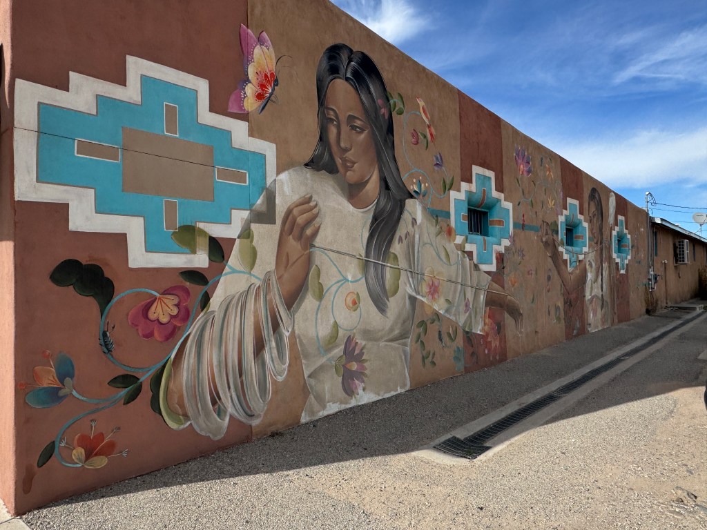
Weaving
Inside the Española Valley Fiber Arts Center we found a class full of weavers creating wall hangings on small looms. In another room we talked with this local woman who regularly works on projects at the center. Fascinating to watch her expertly operate the shuttle and loom.

-
Fiber Arts Center
We stopped at the Española Valley Fiber Arts Center while driving through northern New Mexico. The building’s side wall provides a visual cue to what we found inside.
-
Echo Wall
The concave sheer wall of Echo Amphitheater bounced our words (and songs) back over our heads! The dark streaks are from minerals dripping down the cliff over centuries.

-
City of Gold
The local tribes told the Spanish explorers of the 1500s about cities of gold in the mountains of New Mexico, and from a distance this rock formation would have looked positively golden! Just not the kind that the conquistadors were hoping to find.
-
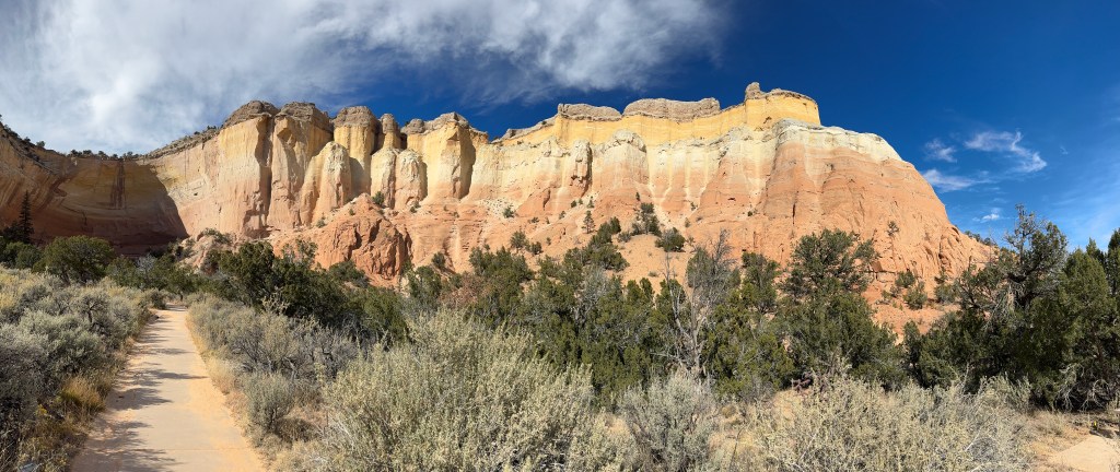
Echo Amphitheater
Driving down a narrow valley in northern New Mexico, we came across this picnic area that featured amazing colored rock layers and a natural amphitheater.

-
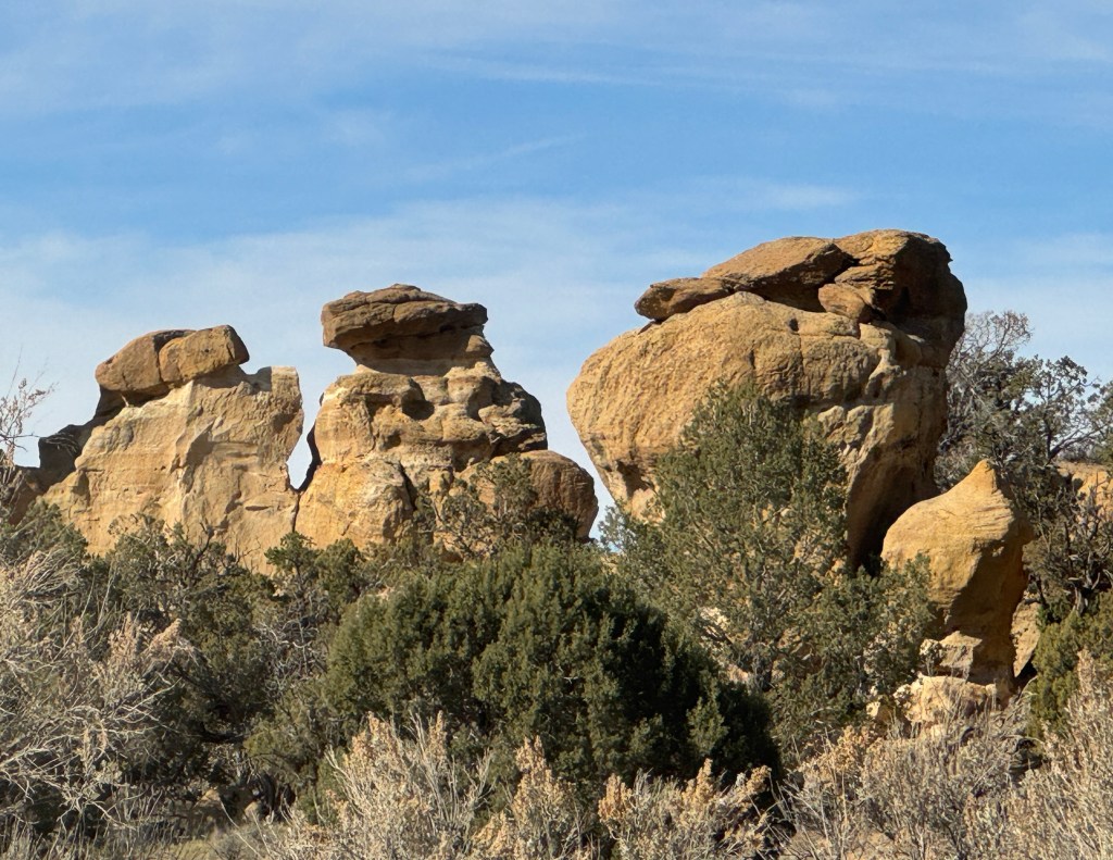
Strange Rocks
Driving south into New Mexico for the first time, we found unusual rock formations on a side road near Aztec, New Mexico. Do you see any faces or profiles in these sandstone giants?
-
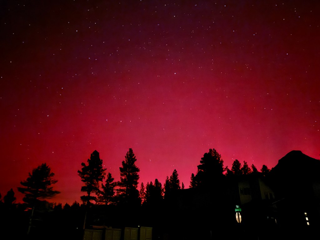
Northern Lights
A major solar flare on November 11th produced this reddish glow above the trees near Durango, Colorado. This was shot with a 3-second exposure to really show the colors, which were more of a faint red to the naked eye this far south.
-
Red Glow
The northern lights lit up the sky over Durango, Colorado on the evening of November 11th with a pinkish-red glow. This view was of the sky above a hillside neighborhood.

-
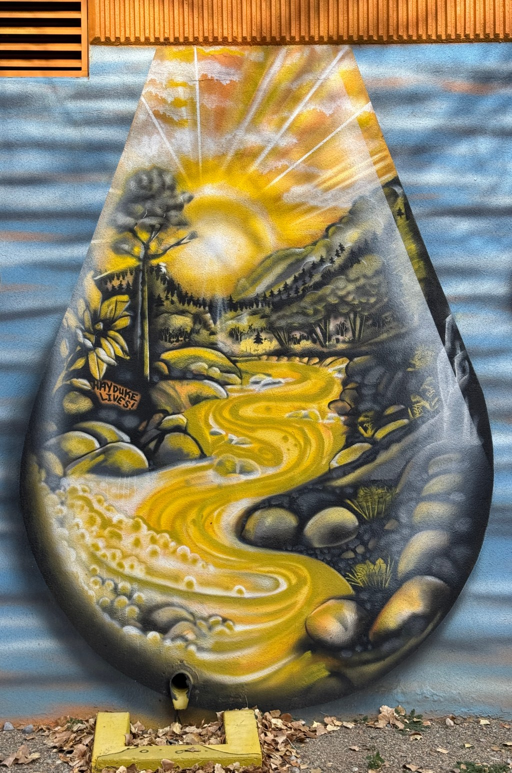
Big Drop
This artwork painted on the walls of the Durango water treatment plant showcases the nearby Animas River, and the golden colors are a reminder of the gold mines that led to the town’s creation.
-
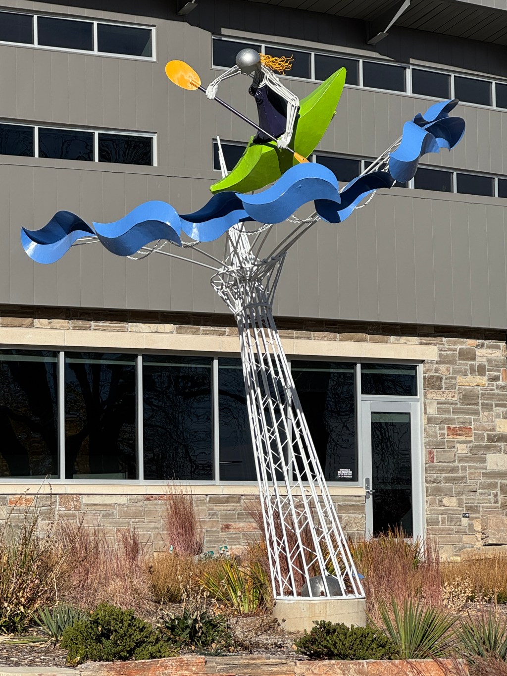
Kayaker Sculpture
This sculpture outside the Durango Chamber of Commerce highlights the whitewater competition that takes place just a few feet away in the Animas River’s spring floods.
-
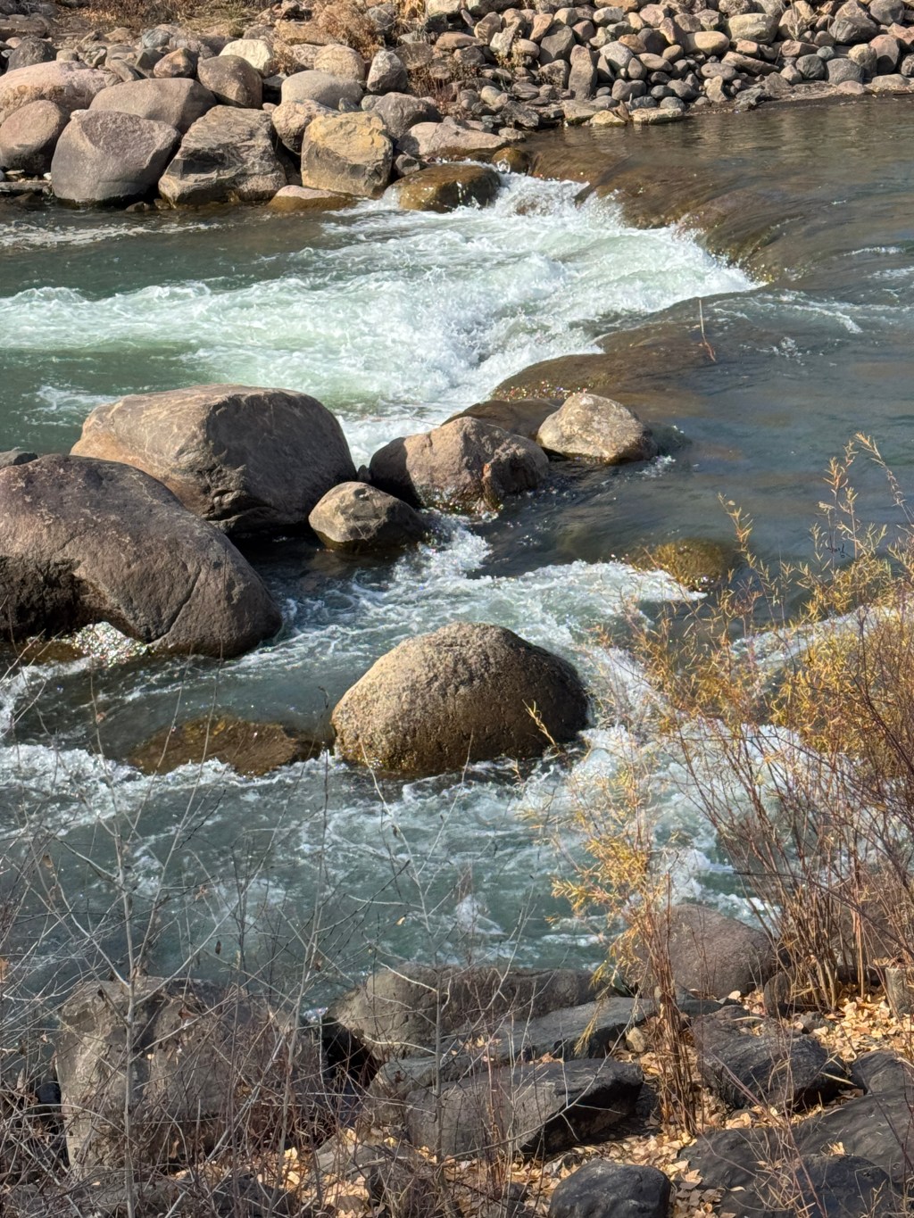
Animas River
The Animas River flows through Durango, Colorado, bouncing around and over rocks in a stretch of rapids that host whitewater kayaking completions in the spring. The water in November was much calmer, but still pleasant to walk along the banks.
-
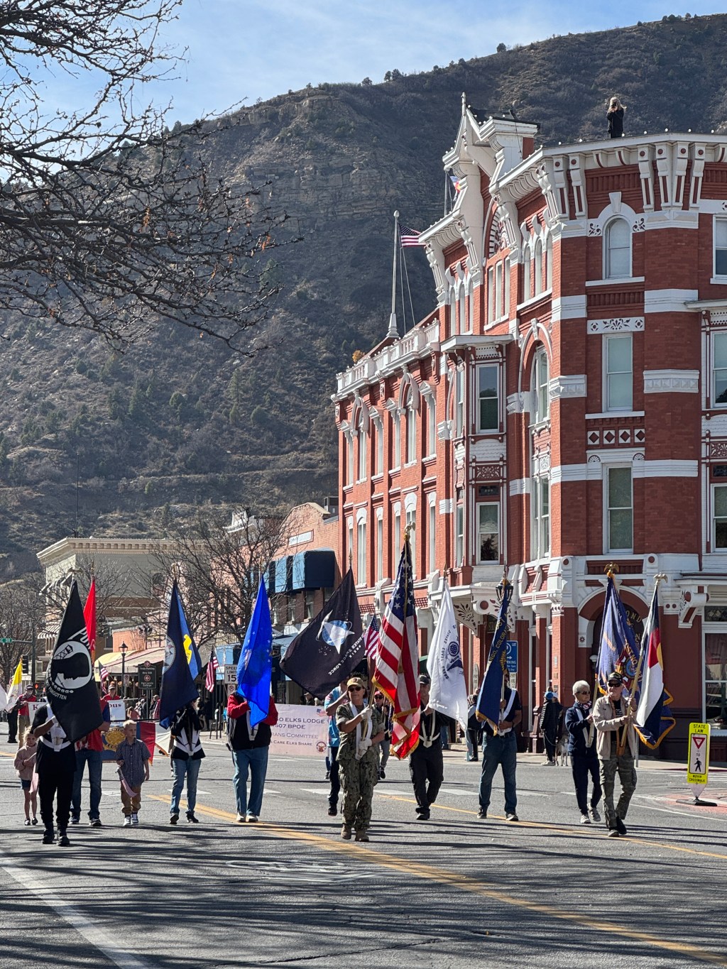
Shriners
Durango’s Veterans Day parade featured the local Shriners in miniature “Tin Lizzies” zooming around the town’s main street. The parade also included full-size classic cars in a variety of styles and colors, all of them loaded with American flags.

-
Veteran’s Day Parade
The Veteran’s Day parade in Durango, Colorado passed the historic Strater Hotel built in 1887. Western author Louis L’Amour wrote a number of novels of the Old West in a room directly above its Diamond Belle Saloon.
-
Durango
Founded in 1881 by the Denver & Rio Grande Railroad, Durango was a boomtown surrounded by gold and silver mines. Today it’s known for outdoor recreation and the narrow gauge steam train that connects it to the mining town of Silverton.

-
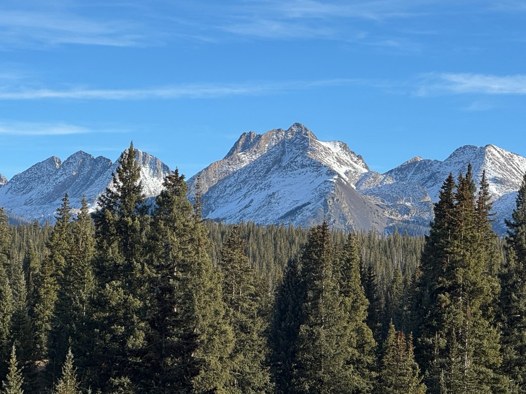
14K Peaks
Near Silverton, Colorado rise several peaks over 14,000 feet high. We saw these mountains from Highway 550, the “Million Dollar Highway.” The road cost $1 million per mile, but the name may also refer to the gold ore in the fill or the spectacular views!
-
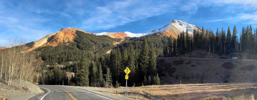
Red Mountain Pass
Rising up to 11,000 feet, the Red Mountain Pass south of Ouray, Colorado is one stunning view after another.
-
Red Mountain
Driving south from Ouray, Colorado, the narrow 2-lane road winds along the edge of vertical cliffs as it rises up to this view of the appropriately-named Red Mountain.

-
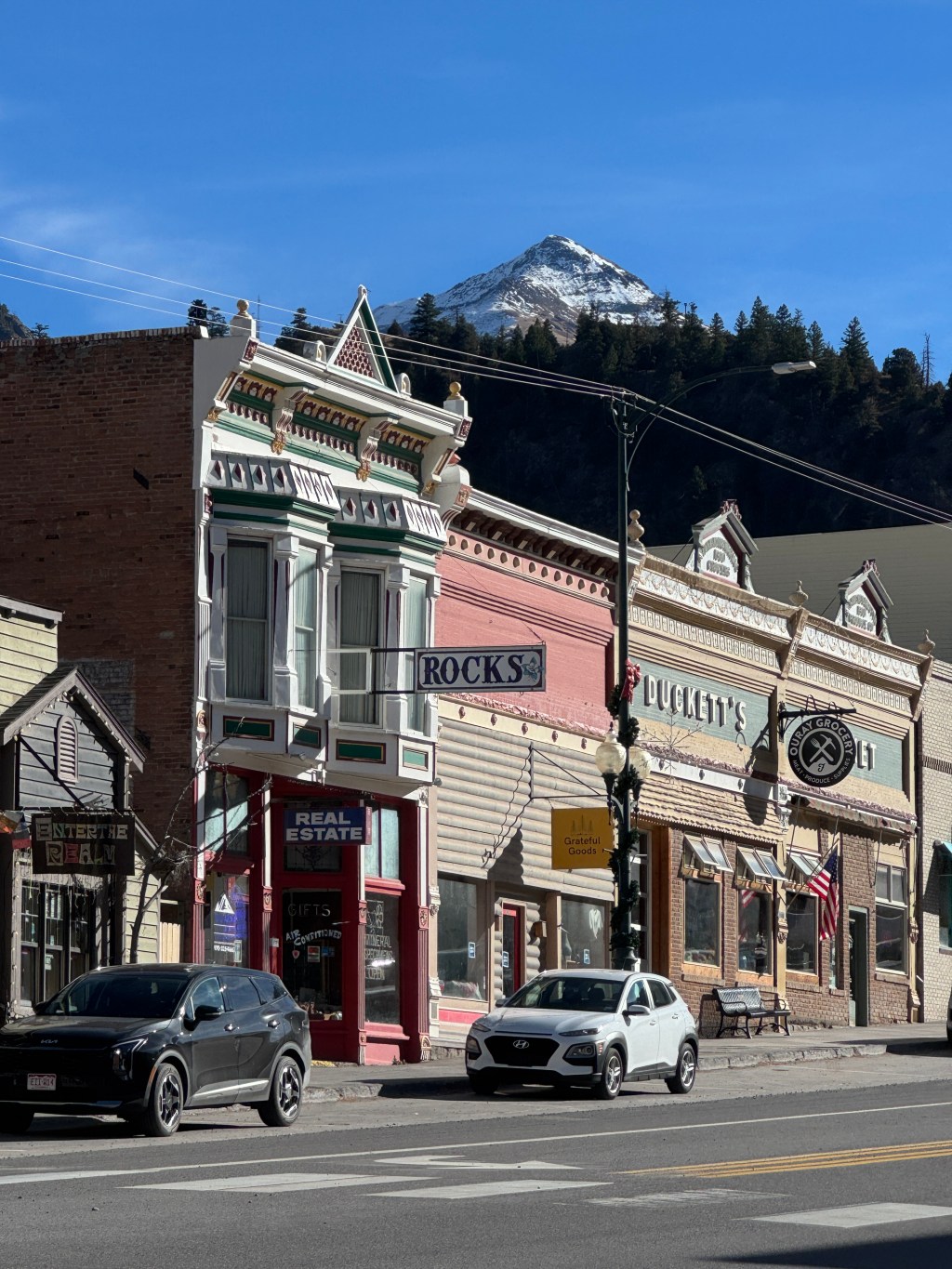
Beaumont Hotel
Ouray, Colorado is surrounded by high cliffs that tower over the town’s 19th century buildings, including the classic-looking Beaumont Hotel. By the way, a local shopkeeper shared that the town name is pronounced “you-ray” and rhymes with “say.”

-
Ouray
Heading south through the mountains of Colorado, we stopped in the town of Ouray to check out the lovely 1890’s buildings on Main Street. The town is named for a Ute chief whose name means “arrow,” although the winding road out of town was anything but straight as an arrow.
-
Family Selfie
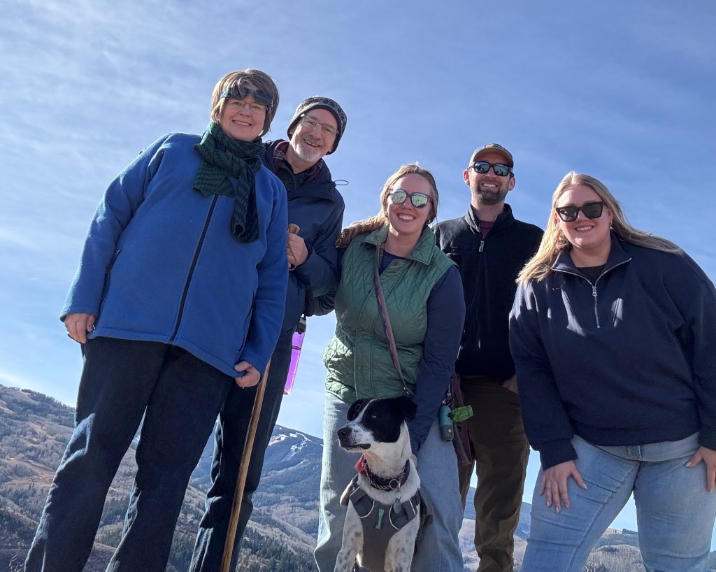
Hiking in the hills above Avon and Edwards, Colorado (at over 7,000 feet), we took a family selfie. From left are Elaine, John, Elizabeth, Jeff, and Hannah, with Elizabeth and Jeff’s bouncy dog Nugget keeping an eye on the other dogs on the trail.
-
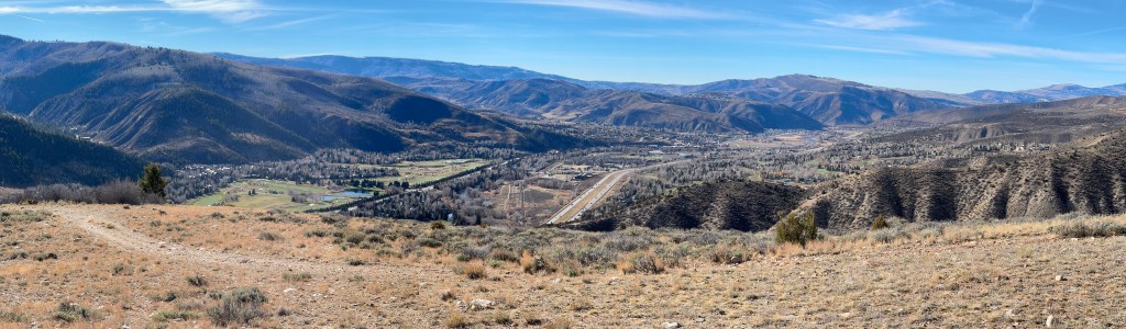
Edwards Valley
Visiting our daughter Elizabeth and her husband Jeff in Edwards, Colorado made for an enjoyable weekend. Here is the view over the valley (their home is under the shaded cliff at the right) where we went for a short hike one sunny afternoon.
-
Mesas
Driving through the Colorado River canyon east of Moab, Utah in early November, the dramatic mesas and buttes competed with the golden-leaved trees for your attention.

